


Zumbro Twp. Voting District, Wabasha County, Minnesota
About
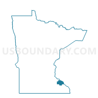
Outline

Summary
| Unique Area Identifier | 604688 |
| Name | Zumbro Twp. Voting District |
| County | Wabasha County |
| State | Minnesota |
| Area (square miles) | 32.20 |
| Land Area (square miles) | 31.59 |
| Water Area (square miles) | 0.61 |
| % of Land Area | 98.10 |
| % of Water Area | 1.90 |
| Latitude of the Internal Point | 44.22179720 |
| Longtitude of the Internal Point | -92.40046750 |
Maps


Graphs
Select a template below for downloading or customizing gragh for Zumbro Twp. Voting District, Wabasha County, Minnesota


Neighbors
Neighoring Voting District (by Name) Neighboring Voting District on the Map
- Chester Twp. Voting District, Wabasha County, MN
- Elgin Twp. Voting District, Wabasha County, MN
- Farmington Twp. Voting District, Olmsted County, MN
- Hammond Voting District, Wabasha County, MN
- Hyde Park Twp. Voting District, Wabasha County, MN
- Mazeppa Twp. Voting District, Wabasha County, MN
- Oakwood Twp. Voting District, Wabasha County, MN
- Oronoco Twp. Voting District, Olmsted County, MN
- Zumbro Falls Voting District, Wabasha County, MN
Top 10 Neighboring County Subdivision (by Population) Neighboring County Subdivision on the Map
- Oronoco township, Olmsted County, MN (2,220)
- Elgin township, Wabasha County, MN (733)
- Zumbro township, Wabasha County, MN (722)
- Mazeppa township, Wabasha County, MN (717)
- Chester township, Wabasha County, MN (455)
- Farmington township, Olmsted County, MN (444)
- Oakwood township, Wabasha County, MN (405)
- Hyde Park township, Wabasha County, MN (286)
- Zumbro Falls city, Wabasha County, MN (207)
- Hammond city, Wabasha County, MN (132)
Top 10 Neighboring Place (by Population) Neighboring Place on the Map
Top 10 Neighboring Unified School District (by Population) Neighboring Unified School District on the Map
- Rochester Public School District, MN (119,931)
- Lake City Public School District, MN (8,831)
- Plainview-Elgin-Millville Public School District, MN (8,000)
- Zumbrota-Mazeppa School District, MN (6,771)
Top 10 Neighboring State Legislative District Lower Chamber (by Population) Neighboring State Legislative District Lower Chamber on the Map
- State House District 29A, MN (48,197)
- State House District 30B, MN (44,957)
- State House District 28B, MN (37,991)
Top 10 Neighboring State Legislative District Upper Chamber (by Population) Neighboring State Legislative District Upper Chamber on the Map
- State Senate District 29, MN (86,779)
- State Senate District 30, MN (83,161)
- State Senate District 28, MN (75,659)
Top 10 Neighboring 111th Congressional District (by Population) Neighboring 111th Congressional District on the Map
Top 10 Neighboring Census Tract (by Population) Neighboring Census Tract on the Map
- Census Tract 19, Olmsted County, MN (6,948)
- Census Tract 4904, Wabasha County, MN (4,532)
- Census Tract 4905, Wabasha County, MN (3,446)
Top 10 Neighboring 5-Digit ZIP Code Tabulation Area (by Population) Neighboring 5-Digit ZIP Code Tabulation Area on the Map
- 55906, MN (17,598)
- 55960, MN (3,134)
- 55932, MN (2,042)
- 55956, MN (1,962)
- 55991, MN (1,490)
- 55957, MN (756)